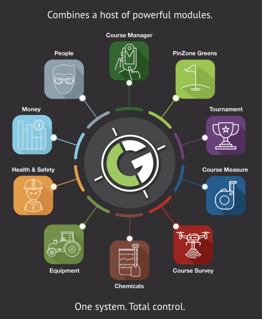
The ClereGolf hub is a unique software platform designed to manage all aspects of your golf business.
The GolfHUB is an on-line portal to manage every aspect of your golf course combining leading edge surveying techniques with advanced data processing we have developed a game changing system that will save time, money and improve the day to day running of your business.
We have developed a game changing system that will save time, money and improve the running of your golf course or event. The 3D geospatial system allows you to interact with the golf course like never before.
This unique software offers the user an accurate virtual reality perspective. You can create, manage, and store your own data and information, either from your desktop pc or mobile phone GPS, live on the course.
Our new technology facilitates a far more accurate, interactive and intuitive way of working and communicating among your staff or contractors.
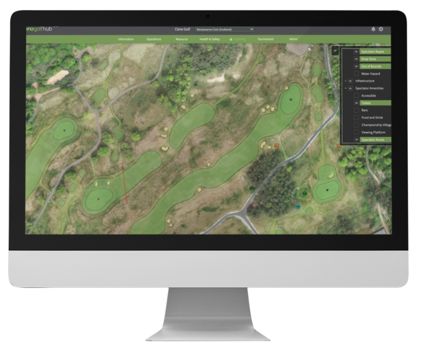
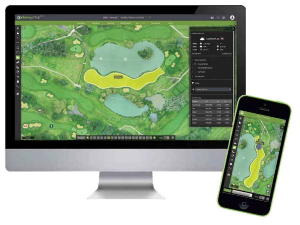
Tournaments
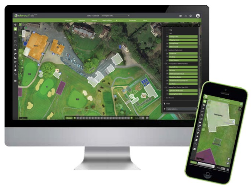
The perfect visual communications tool for Tournament Directors to seamlessly create, store and share venue set-up information – with staff, contractors, venues and partners – all in a single place.
- Our app software works on ordinary mobile phones to view and add accurate data live out on course
- The desktop software is also fully functioning for desktop computers
- We also offer a simple GPS enhancement for your mobile phone to increase recording accuracy down to 30cm
- Plan all tournament infrastructure and course information from scoreboards and public facilities, through to pin and tee positions, spectator ropes, television cables and grandstands – all accurately recorded and stored – ready to share
- Health & Safety information for spectators, construction workers, players and staff
- Ground contouring to help assist the planning of tournament set up or infrastructure
- Measurement tools, driving arcs and fairways widths to help plan course set up
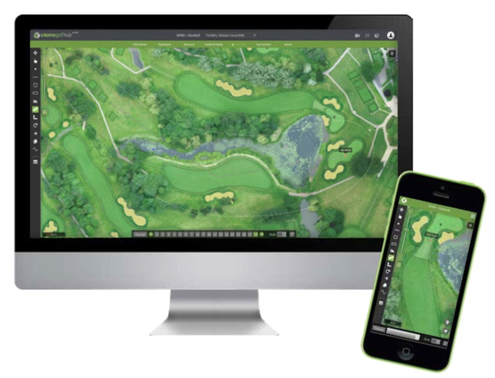
Course manager – ‘Above & Below’ plans
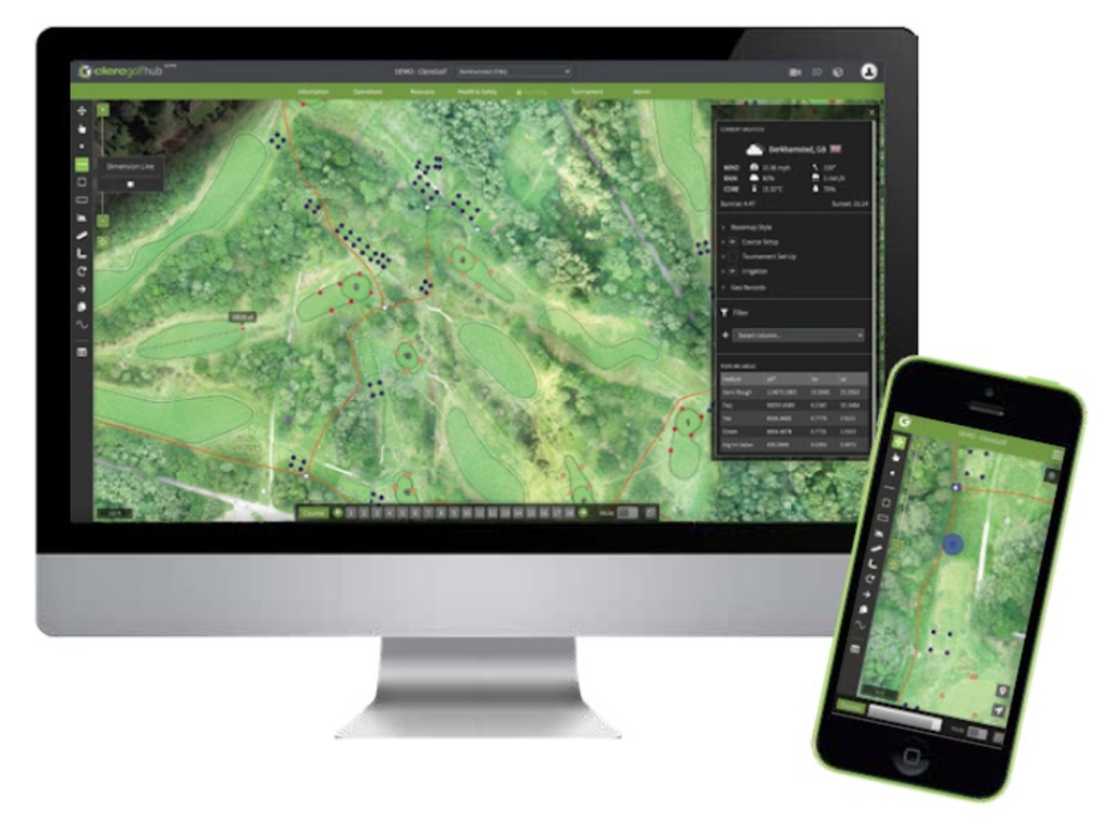
course manager – ‘above & below’ plans
Often historical pipework and below ground plans are hard to find and difficult to access. Through our course manager everything can be stored geo-spatially against a present-day aerial image for easy access anytime, anywhere:
- Irrigation systems can be GPS mapped or uploaded from ‘as-built’ plans and stored in ‘layers’ for the users to tailor their view
- All information can be viewed on your GPS enabled mobile device allowing users to easily locate any component while on-course (just like a satellite navigation system)
- Think of the HUB as a blank canvas on to which a host of data can be placed from pipework, gas and electricity, sub air systems, property boundaries…
- Excavate in confidence knowing the precise location of any services below ground by knowing your location and that of any pipework
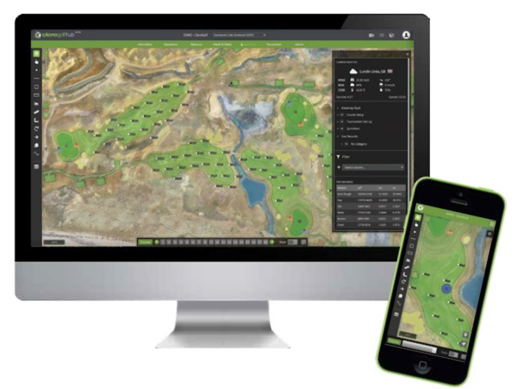
Sprinkler Systems
course manager – sprinkler systems
As new sprinkler systems are installed or existing systems updated or extended, it’s vital to maintain an up-to-date records of what has been installed where. Through the HUB you can record the precise location of each sprinkler with ease and accompany each ‘geo-record’ with notes that can be stored, shared and reviewed:
- Maintain an up-to-date record of all sprinkler heads including it’s GPS location, manufacturer and head type
- Use your GPS enabled device to locate hard to find sprinklers and heads when on the course
- Know the precise distance from every sprinkler to the front/middle/back of every green. Ideal when ordering and installing distance tags
- With A4 and A3 ‘long hole view’ print capabilities you can take hard hole layouts on-course for manual checks or use your GPS device when carrying out routine maintenance
Feature Analysis at your fingertips
course manager – feature analysis at your fingertips
Integral to the HUB is an incredibly accurate present-day aerial image captured of your course during our on-site survey. Upon processing this image our skillful in-house team carefully outline each and every feature on all holes allowing you to:
- Select any feature such as a tee, green fairway or bunker and know it’s exact surface area
- Move through the course in a ‘hole-by-hole view’ and see the summary of feature areas for that hole
- Ensure ‘seeds and feeds’ are purchased efficiently by basing your orders on precise measurements
- Apply application rates of chemicals with confidence in the knowledge that concentration levels are optimised
Remote measuring & planning
course manager – remote measuring & planning
With sub 10cm accuracy across your entire course at your finger tips from any web enabled desktop or mobile device you can measure distance and area from home or office as precisely as you could on the course.
- Accurately plan new tee or bunker construction by creating the features inside the HUB before measuring hole lengths, and driving distances to / from them.
- Maintain an up-to-date record of all sprinkler heads including it’s GPS location, manufacturer and head type
- Use your GPS enabled device to locate hard to find sprinkler heads when on the course
- Know the precise distance from every sprinkler to the front/middle/back of every green. Ideal when ordering and installing distance tags
- With A4 and A3 ‘long hole view’ print capabilities you can take hard hole layouts on-course for manual checks or use your GPS device when carrying out routine maintenance
Geo records
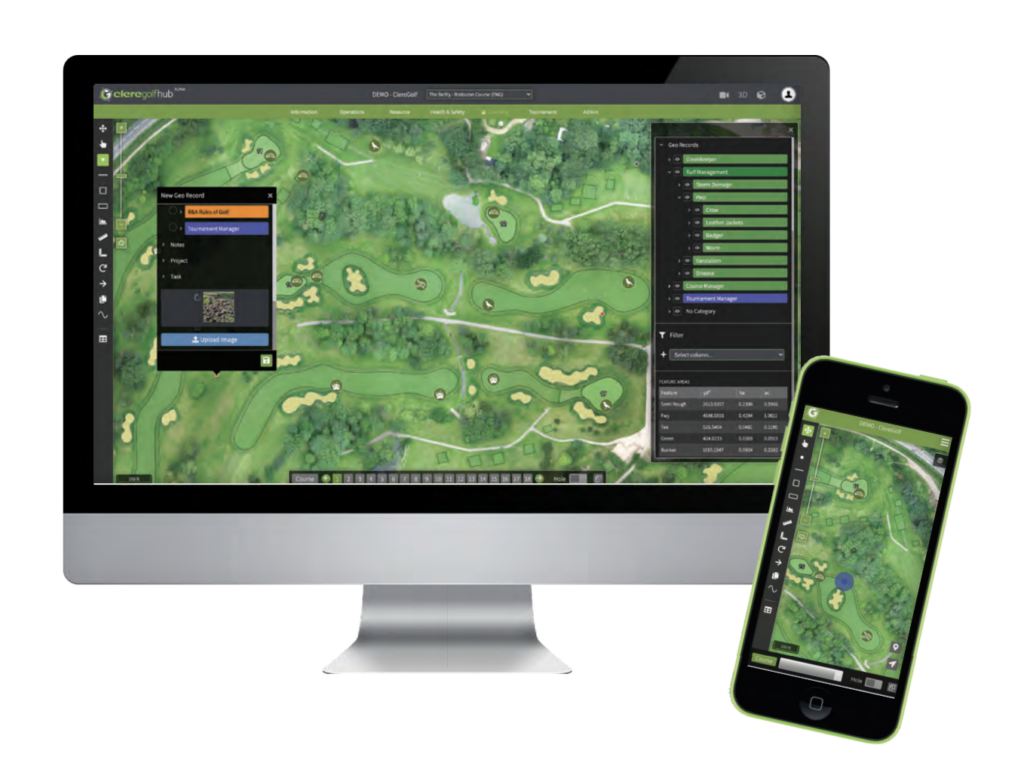
course manager – geo records
The golfHUB really comes into it’s own with the ability to create geo-records (a records that is stored against a specific location), these records can be viewed against the map and navigated to using your GPS enabled device as you would with a satellite navigation system so that you can:
- Capture photographic evidence of incidents such as ‘pest’ or ‘disease’ while on-course
- Create categories against which your geo-records can be assigned allowing filtered records to be visualised against your map
- Quickly build a visual representation of activity across the course such as tree falling, pollarding, path repairs, vandalism, flooding (whatever you wish!)
- Streamline course walks by creating records relating to work to be actioned with accompanying notes while on-course
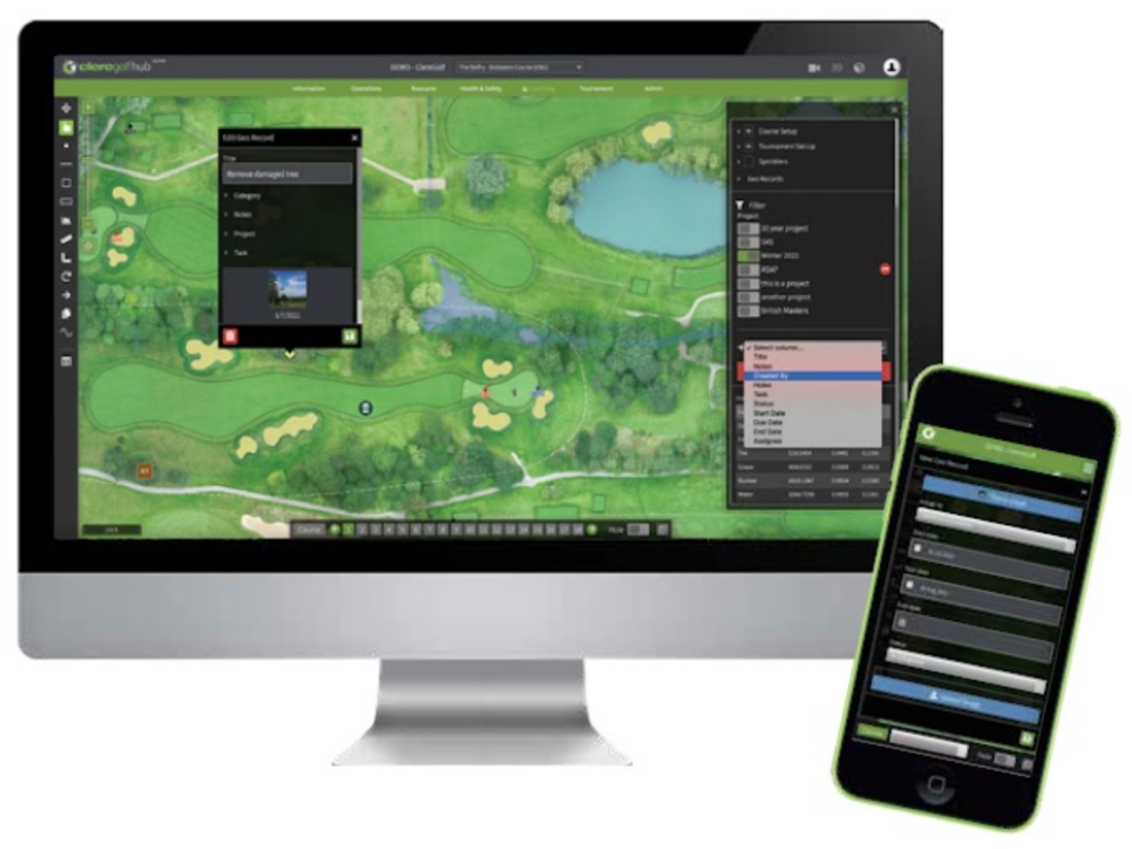
Task Management
course manager – task management
Not only can geo-records be created, shared and reviewed but each can also generate a task and assigned to members of your team:
- Use your mobile device to photograph parts of the course that require attention, add notes and assign a member of staff for action
- Create ‘projects’ such as Winter Program or Bunker Renovations against which tasks can be attributed and progress monitored
- Stage virtual course walks away from the course suing hole-by-hole view and intuitive filters in order to navigate through each hole reviewing ‘work in progress’ or ‘outstanding jobs’
- A great way to instantly record issues spotted while on-course with photographic evidence!
Event & Structural Planning
course manager – event & structural planning
Staging events requires extensive planning with temporary structures carefully positioned, amenities strategically located and service points conveniently spread across the facility. Storing this information geo-spatially makes perfect sense and enable you to plan remotely then navigate to the precise locations when on-course:
- Record the physical location of a temporary structure by walking its perimeter with your GPS device, once saved it can be located in subsequent years
- Plan precisely where you want spectator ropes to be located from your desktop then head out on the course and ‘walk the line’
- As structures are drawn the HUB will display the exact size/area so that you know the structure you are creating is to spec
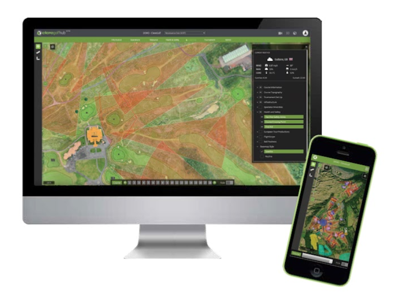
Health & Safety
course manager – health & safety
Not only can geo-records be created, shared and reviewed but each can also generate a task and assigned to members of your team:
- Overlay course topgraphy to better understand the severity of slopes and identify areas of exclusion for certain machinery
- Display ‘driving cones’ in order to identify areas of risk for spectators
- Attach risk assessment documentation to physical locations or temporary structures for fast and effective recall
Additional Media
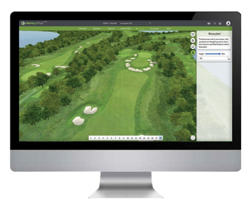
course manager – additional media
Staging events requires extensive planning with temporary structures carefully positioned, amenities strategically located and service points conveniently spread across the facility. Storing this information geo-spatially makes perfect sense and enable you to plan remotely then navigate to the precise locations when on-course:
- Immerse yourself with a fully interactive virtual walk through your course. Great for website and social media
- Used by event staging teams to ‘drag and drop’ pre-built structures on to the course for review pre-build
- As structures are drawn the HUB will display the exact size/area so that you know the structure you are creating is to spec
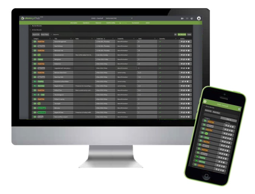
The Dashboard
course manager – the dashboard
Supporting the ‘course view’ of all geo-records created is the ‘dashboard’ where all records can be filtered, sorted and exported to CSV for offline investigation.
- 3 distinct dropdown views neatly separate ‘my tasks’ and ‘my geo-records’ from ‘all geo-records’ created across your facility for fast and effected review
- Hyperlinks will take you directly from any line item to the precise location of the geo-record within the map view
- Intelligent one-click filtering enables users to drill down into record categories with ease
- Review on the go by accessing the ‘dashboard’ through your mobile device
© 2026 DPP Golf